Every Day is Water Day

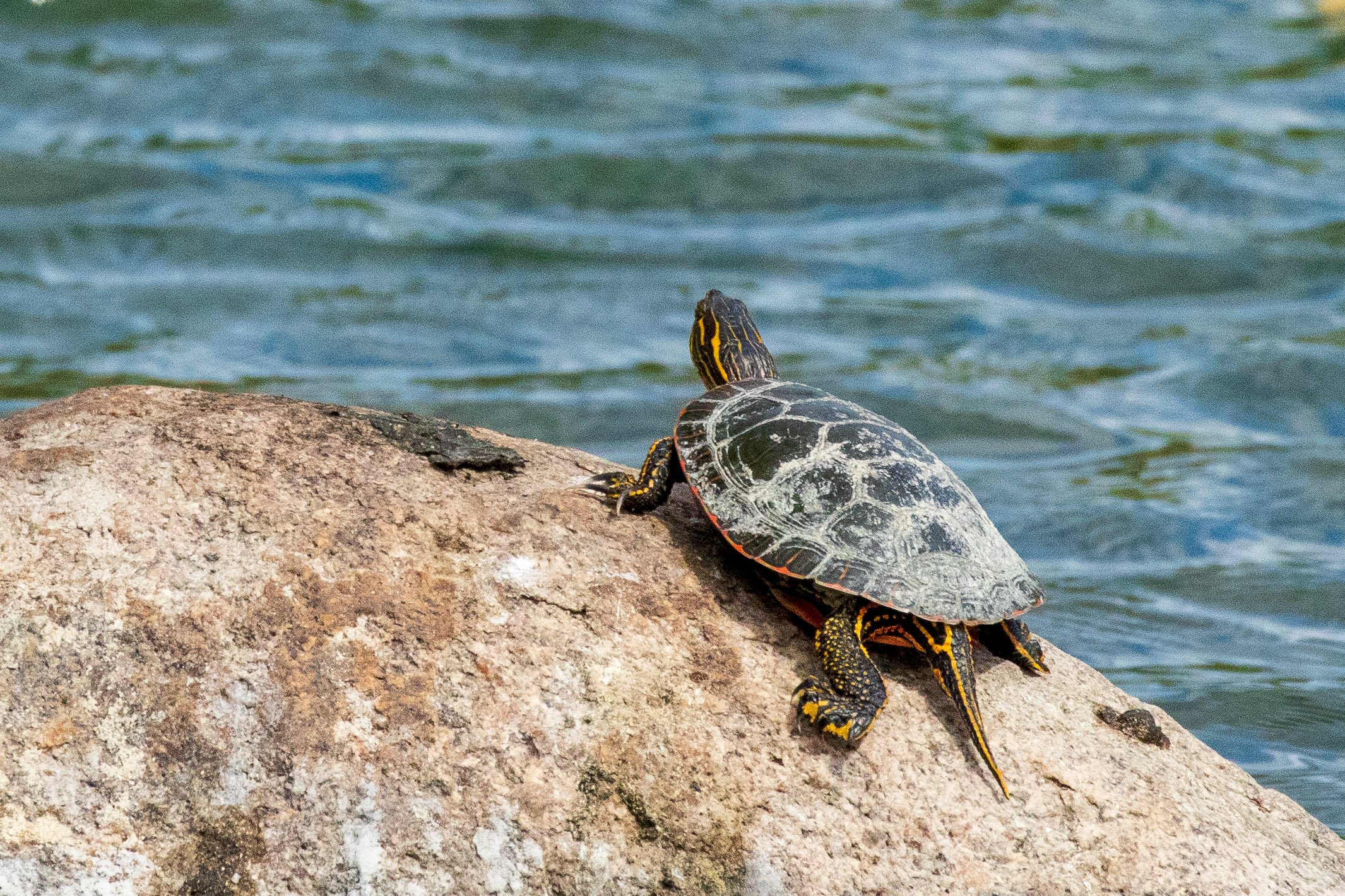
A kéya — turtle — sunbathes on a rock at Wakáŋ Tipi.

Mní —water — is its own being; it is a sacred force of life which sustains all relatives of Iná Makóc̣e — Mother Earth. Water connects us all as human beings, and the fate of our waters, whether we care for them, disregard them, or exploit them, will determine the health and longevity of our communities. Although World Water Day is observed on March 22nd by the United Nations, at Lower Phalen Creek Project we understand that every day is water day, and each day is a new opportunity to advocate for the sustainability and care of our freshwater resources. In this month’s blog, we’ll discuss the current state of some East Side St. Paul waters and introduce our plans for expanded water quality testing and monitoring at Wakáŋ Tipi.

Troubled Waters

As spring approaches, our lakes, rivers, and creeks will thaw to reveal entire ecosystems hidden for months beneath a blanket of snow and ice. Relatives like freshwater turtles will come to the surface from their deep state of rest to take their first full breath of the year and bask in the sun. New aquatic life will bloom as the temperatures rise, giving way to a world of activity just below the water's surface. With warmer days comes snowmelt, which also means that anything present on our roads and driveways will enter into our lakes and waterways. 

Unfortunately, the state of Minnesota has increasingly struggled with the acidification of our waters from winter road salt. Even small increases in chloride can have major impacts on sensitive aquatic species and whole ecosystems. Runoff with a high concentration of salt is denser, which will sink to the bottom of lakes and prevent the natural turnover that occurs within them, thereby reducing oxygen and killing fish.

Local waters in urban environments are especially susceptible to chloride pollution. In St. Paul, both Battle Creek and Lake Como remain on the list of chloride impaired waters. The Minnesota Pollution Control Agency (MPCA) classifies watersheds with a road density above 18% as “critical areas where implementation efforts to reduce chloride coming from de-icing salt should be focused.” The Lake Phalen watershed is currently at 26% road density, making it a top priority for chlorine input reduction practices.

However, Lake Phalen was newly placed on the draft 2022 list of impaired waters for a different contaminant… perfluorooctane sulfonate, better known by the acronym PFOS. PFOS belongs to a class of industrial chemicals (including PFAS and PFOA) commonly used to produce a variety of consumer goods including water repellent fabric, grease-resistant paper, and even certain shampoos. These virtually indestructible chemicals were developed by 3M, a stalwart of Twin Cities industry responsible for contaminating the drinking water of over 140,000 Minnesotans from negligent PFAS disposal. There is still no technology in existence which can remove these chemicals from our drinking water, and their full effects on people and the environment are not yet known. For now, the consumption of fish from Lake Phalen is no longer recommended by the MPCA, and this pollutant will remain in our urban waters at unsafe levels for the foreseeable future.

One sign of hope: last fall the Biden administration announced a multi-agency strategy to better regulate, cleanup, and research PFAS chemicals. The Defense Department will begin assessing and remediating PFAS contamination, which has been detected at over 400 military bases, while the Agriculture Department will work to prevent PFAS contamination of food. The EPA is simultaneously taking multiple steps to regulate PFAS, including proposing strict drinking water limits of PFAS under the Safe Drinking Water Act and designating PFAS as a hazardous substance under the Superfund law, which will force the companies responsible for PFAS pollution to pay for cleanup. These actions are just the beginning, as they will need Congressional backing to be fully effective, but they mark a national shift away from largely ignoring PFAS pollution and the harms it can have on our bodies and our environment to taking it seriously.

Water flows along the base of the bluffs at Wakán Tipi.

Morning light reflects off the streams at Wakáŋ Tipi.

Water as a Shared Responsibility

While large urban water bodies like Lake Phalen are well-studied and monitored, there are a number of smaller waters and waterways across the metro receiving less attention. Within the bluff-fed springs and wetland ponds of Wakáŋ Tipi itself, the presence and level of contaminants like chloride, PFAS, and many others is unknown. This is in part a matter of priorities – larger waterways tend to have more recreational uses (swimming, fishing, etc.), and the monitoring of water quality in these places is more readily framed as a matter of safety and public health. But what about the health and safety of the nonhuman relatives of our ecosystem? And what about the ways our waters are used for ceremony? The numerous paths water takes through our watershed leave many possible points of pollution input. Whether it is road salts carried with snowmelt into your storm sewer, rain or water vapor picking up air particles, or any number of other potential pollutants, these inputs have consequences for the plants, animals, and soils of our shared green spaces. Without a structure in place to track these inputs, we can’t know how much damage is being done to our ecosystem, much less how to treat it. 

In 2022, Lower Phalen Creek Project has a few opportunities to address these issues. First, we are working with a growing team of researchers to analyze the flow of water throughout Wakáŋ Tipi – this includes monitoring the fluctuation of water levels, sampling water and wetland sediment, and increasing our general knowledge of the baseline hydrology at the site. 

As we begin our first season of water quality monitoring at Wakáŋ Tipi, we also have our eyes on a larger project: the daylighting of Phalen Creek! The myriad water quality benefits of restoring 3+ miles of this East Side stream include the return of aquatic habitat (phytoplankton, amphibians, fish, macroinvertebrates, and more) and significant improvements to urban stormwater management. In 2022, as LPCP is slated to begin the design for the daylighting of Phalen Creek’s headwaters, it is estimated that this first ¼-mile stretch of the creek will divert – and treat – over 7 acre-feet of stormwater each year. For reference, that’s 7 Olympic-size swimming pools! 

This spring, as you watch the massive snow piles shrink down and listen for the distant peals of thunder, consider how you can honor the gift that is water. Adopting a storm drain can help keep trash and debris out of our stormwater infrastructure. Using low-flow plumbing fixtures on your faucets and shower-heads can help your home use less water for everyday tasks (and keep your water bill down!). Converting your lawn to native plantings or installing a rain garden near your home can improve soil quality and water filtration in your neighborhood. Whether you’re able to take these steps or not, know that you can also be an advocate and a voice for mní— water — every day of the year.

The Continuation of Indigenous Science

A bird lands amongst the tall grasses of Wakán Tipi. This year bird, small mammal, and pollinator surveys will continue on site.

A new world of understanding has come to the forefront in recent years as more and more trailblazing Indigenous scholars enter every level of academia, bringing their lived experience and inherited knowledge with them. Their scholarship focuses on the incorporation of Indigenous methodologies into every subject area, be it the arts, history, or science. Doing so simultaneously pushes back on the colonial structures, such as education and western science specifically, that have historically been exclusive and inflicted harm on their communities. Pivotal works like Robin Wall Kimmerer’s Braiding Sweetgrass have brought the subject of traditional ecological knowledge (TEK) into the public consciousness, as we simultaneously see a shift by the dominant culture from devaluing or appropriating Indigenous ways of understanding the world to appreciating them and the people who practice them. Perhaps the greatest lesson we learn from Indigenous science is the acceptance of multiple ways of learning, attaining, and keeping knowledge. Whereas traditional western science seeks to uphold a single “correct” answer to scientific inquiry and struggles to reconcile conflicting viewpoints, Indigenous science readily accepts a multiplicity of truths and perspectives. But the point of this blog post is not to put Indigenous science and western science in opposition — rather, we wish to highlight the ways in which we draw from Indigenous science to further our work at Lower Phalen Creek Project.

Decolonization refers to the process of deconstructing colonial ideologies of the superiority and privilege of Western thought and approaches.”
— Pulling Together: A Guide for Curriculum Developers

New (Old) Ways of Knowing

Foundational to Indigenous science is the incorporation of perspective, narrative, and the oral tradition. In Dakota practice, citing our sources (a.k.a. knowledge keepers) has always been key to keeping our history alive. Stories, including those that help explain the natural world, are viewed as gifts and we honor those who took the time to share them by directly acknowledging them. Unfortunately, oral teachings have long been excluded from scientific publishing. The dominant culture has always promoted and preferred written documentation in the sciences, ultimately discrediting the oral tradition. For years, this has made it difficult for many scholars to incorporate TEK and generational understandings into their field of study. Lorisia MacLeod, a librarian and member of the James Smith Cree Nation, sought to change that when she developed templates for citing oral teachings in the commonly used MLA and APA formats. The new templates include the name of the elder or knowledge keeper, their nation or community, and the date the story was told, all of which are common practice when retelling traditional stories in person. This new tool will help to normalize the inclusion of TEK in academia and aid Indigenous students as they conduct research to better their communities.

Binnizá-Zapotec and Ch’orti’ scientist Dr. Jessica Hernandez is also making big moves within the sciences by presenting a different framework for restoration based on Indigenous worldviews and a holistic approach, while challenging the traditional notions of conservation. Her new book Fresh Banana Leaves: Healing Indigenous Landscapes through Indigenous Science explores the complex relationships Indigenous peoples have with our homelands and the ways we can heal them. She also confronts the harmful rhetoric within the conservation movement that continues to pit humans against their environments, specifically by use of the term invasive species.

“I have sat in many presentations about invasive species where they have been called the devil, evil, or nightmares. … Yes, invasive species harm an entire ecosystem, sometimes outcompeting all native plants in this same landscape; however, we are taught as Indigenous peoples that regardless of whether this plant belongs there or not, we must ask its spirit for permission. As I shared before, we acknowledge them as displaced relatives rather than invasive species, since at the end of the day, they are also someone’s plant relatives.” —Jessica Hernandez

Lower Phalen Creek Project understands that language matters: we ourselves have transitioned away from using the term “invasive species,” and instead use the phrase “displaced plant relatives.” This change acknowledges the ongoing connection we hold with our lands, reminds us of our responsibility as caretakers and limits any negativity we bring into the restoration of a sacred site like Wakáŋ Tipi. We are happy to see these practices brought to light on an international stage, and promoted in the work of both Dr. Jessica Hernandez and Lorisia MacLeod.

Incorporating Dakota Lifeways

If we are of the modern type of mind, that sees in natural law a majesty and grandeur far more impressive than any solitary infraction of it could be, let us not forget that science has not explained everything.”
— Ohiyesa, Charles Alexander Eastman

As a native-led nonprofit which focuses on Dakota cultural teachings in our care for the Dakota sacred site of Wakán Tipi, ethics are at the forefront of any and all scientific exploration we pursue. There are many questions we continually ask ourselves and seek guidance on before we move forward with planning or implementation. This process is intentionally done so that we move forward with our work “in a good way.” Some of the main questions we ask and practices we follow for any project include:

  • Will this research be a benefit to our relatives, and if so, how? We ask this question with the understanding that some answers are not needed and there will always be a limit to our knowledge. Knowing for the sake of knowing is not always the best practice. It is important that research be done if it can benefit our human or more than human relatives.

  • How do we share what we learn with our communities and how do we involve them in the learning process? Community involvement is key. We seek opportunities that can include our communities — and youth, in particular — in the research process. We also believe in transparency, and want to disseminate what we learn to the public.

  • How do we respect our relatives, be they plant, animal, human, water, or the land itself? Everything we do is based on woóhoda — respect for those around us. We would never want our scientific inquiry to cause unnecessary harm or damage to the ecosystem or to individual beings.

  • Slow Science. Every action taken should be done deliberately and with careful thought or planning. We don’t want to rush to find an answer or force a change on the landscape without taking time to really think about it first. The research we conduct should be done with intentionality and meaning, so that we do not race to unintended consequences.

Upcoming Projects

As we work to conduct more activities that fall into the broad category of “community science,” we are doing so with the questions listed above at the forefront of our minds. What do we want to know about the goings-on of the world around us? Just how do we go about this learning “in a good way”? How do we ensure we do not seek knowing for the sake of knowing, and instead pursue the education and knowledge which aligns with Dakota perspectives and lifeways? 

Day by day, the sun rises earlier and sets later. The Kiŋyáŋpi Oyate will soon welcome many winged relatives back to the lands and waters of Mni Sota. The turbulent temperatures of spring’s freeze-thaw cycle will kick off in earnest, giving native plant seeds the time they need to stratify, germinate, and bear new life. Our native pollinators will leave nests burrowed into soil and woody stems in search of pollen and new homes. Snowmelt and spring storms will carry water through our lakes and streams, coursing renewed life and energy throughout our ecosystem. And soon, we will find ourselves in the midst of this explosion of activity, watching with awe and wonder. The western practice of phenology is remarkably philosophical, asking us only to document what we observe to be changing all around us. And in pairing this practice of observation with a dutiful sense of woóhoda, with community involvement, and with this series of reflective questions in our minds, we aim to form our own coherent approach to Indigenous science.

In 2022, we will work with a range of volunteers, academics, and other community members to learn more about the infinite changes and processes on display throughout Wakáŋ Tipi. We’ll conduct surveys on the growth and prevalence of plant relatives, birds, pollinators, and mammals. We’ll use technological devices to learn the chemical and mineral make-up of our soils, air, and water. We’ll work to synthesize the information we gather so that everyone in our communities may understand its value and importance. And through it all, we’ll place our values and our intentions first. In the end, we seek not to “explain everything,” but simply to become more aware and better informed on what has always been in front of us.

Visiting with the Kiŋyáŋpi Oyate

A group of people in winter coats look up at the sky for birds.

“I prefer (...) my excursions into the natural gardens where the voice of the Great Spirit is heard in the twittering of birds, the rippling of mighty waters, and the sweet breathing of flowers.” — Zitkála Šá

There is a special bond between our winged relatives and all members of the Očéti Šakówiŋ. From as far back as our very creation stories take us, birds have been sharing their knowledge and shaping our lives with their contributions to our ecological community. In our traditional stories they play many roles including that of a messenger, being a helper or a foe, having great creativity and cunning or being gullible, but always possessing their own will and way to do things. We have yet much to learn from the Kíŋyaŋpí Oyate-the Flying Nation, whose members are now at risk due to loss of habitat and climate change among other things. This month’s blog focuses on the gifts these cherished relatives continue to share with us, the threats they face in a changing landscape and the role we play in aiding them.

Who Sticks Around for the Winter?

Wakáŋ Tipi has not only been an important gathering place for humans from time immemorial, it has also been central to the lives of innumerable bird species. Directly adjacent to the life sustaining waters of Wakpa Taŋka-The Mississippi, Wakáŋ Tipi is situated along the largest migratory route in the country, called the Mississippi Flyway. This flyway is one of just four in the United States and is where almost half of all bird species spend at least part of their lives, making us two-leggeds incredibly lucky to witness the number and diversity of bird relatives we do throughout the seasons. 

The unique and varied habitat of Wakáŋ Tipi also makes it the perfect home to numerous bird species at any point in the year. Especially in the summer, the open prairie attracts grassland species like the meadowlark, sparrows, and goldfinch while the fruit-bearing shrubs and trees attract robins, bluejays, and cardinals. The ponds are frequented by waterfowl like mallards even in the coldest months. Red-tailed hawks, turkey vultures, and eagles can often be seen soaring along the overlooking sandstone bluffs. Even an owl has been spotted amongst the trees!

On a chilly morning last month we joined leaders from the Urban Bird Collective and over twenty members of the community for a winter bird walk at Wakáŋ Tipi to see which of these birds have stuck around for the season. By simply walking the length of the sanctuary, observing the distinct species and the number of individuals present, and documenting this information, the group provided a valuable set of data. (We’ll discuss more about the incredible potential of community science projects later on!) However, as has been discussed on our blog before, this event was about more than data. As important as the cataloguing of wildlife is, so too are the relationships we build with the other beings with which we share this home. Birds after all are not just numbers, they are relatives. And when we venture out to see which of them remain in Mni Sóta throughout the winter months, we must do so with respect. It is in this way that our partnership with Urban Bird Collective has been so joyful; our colleagues recognize the critical importance of making the act of birding accessible and meaningful for everyone in our communities. Carrying ourselves in this way, and collaborating with those who share their knowledge and perspectives on birding with us all, we can move through Wakáŋ Tipi with confidence and comfort.

Listed below are just some of the many birds we witnessed on our walk with UBC last month and the gifts they bring to our ecosystem.

ŠiŠóka

American Robin

This relative resides near Wakáŋ Tipi year-round. In the winter months, you’ll find robins searching for fruit (which makes up almost 60% of their diet!) on the branches of hackberry, nannyberry, and highbush cranberry, or taking a bath in the open water of the bluff-fed springs.

WaŋbdítHaheya

American Goldfinch

Even though that golden plumage may dull slightly in the winter months, you’re just as likely to hear a goldfinch as see one! Watch for them in shrubby, weedy stands and near open fields.

KHaŋǧí

American crow

Social, intelligent, and resilient — what’s not to like about crows? Their flexible and wide-ranging diet, as well as their critical thinking, make them well-adapted to living near human communities. Their large gatherings can get a little loud, but otherwise, they’re good neighbors!

phačhaŋšihúta

house Sparrow

Perhaps one of the relatives we spend the most time with, sparrows have taken to the human way of life. You’ll find them nesting in buildings or hopping around on the ground in search of seeds and insects.

WičhátHaŋkaDA

Ring-Billed gull

This waterbird makes its home on the shores of the Wakpa Taŋka. Gulls aren’t too picky about what they eat — even food scraps and other trash are fair game! Limiting single-use products and properly disposing of our garbage helps keep these relatives healthy.

Thatéte Čhaŋnúŋǧa

Downy woodpecker

The smallest woodpecker in North America is busy these months — drilling for insects requires a bit more work, and it’s also mating season! Listen for these relatives drumming to each other, and spot their carpentry skills in dead trees and branches.

Thiwákiŋyeda

rock pigeon

Another familiar face, the pigeon has long been one of humanity’s closest winged relatives. Brought to Mni Sota by European settlers, pigeons have adapted to urban life, nesting high up in skyscrapers and subsisting mostly off of food scraps we leave behind.

PHaǧúŋta

Mallard

You’ve seen them around — mallards are one of the most familiar and most abundant ducks in the world! Though they often make their nests a mile away from open water, they spend most of their time in the many lakes and waterways of Mni Sota.

Thoskáda

Hairy Woodpecker

No, we didn’t take two photos of the same bird! Hairy woodpeckers are larger, and have a longer bill than their close relatives. Outside of a similar mating season, they spend more of their time on bigger branches and trees to feed a big appetite.

phačhaŋšihúta

dark-eyed Junco

Typically woodland-dwellers, juncos share some similarities to other sparrows, and can vary widely in appearance. They do most of their nest-building and foraging close to the ground, and in the winter, they eat mostly grass seeds.

čhaŋšká upíǧi

REd-Tailed hawk

This high-flyer might like to get involved in our community science work: each summer, we conduct a survey of small mammals living in the prairie and woodland ecosystems. These voles and mice make for good eating!

waŋbdí | aŋúŋkhasaŋ

Bald eagle

DDT and other toxins once threatened the very survival of the Waŋbdí, and it is only within the last twenty years that we have begun to see this beloved relative return to Mni Sota Makoce in strength. Stretches of open water along the Wakpa Taŋka, high bluffs, and tall cottonwoods make Wakáŋ Tipi the perfect home for a nesting pair.

Ways to Help

Due to a changing climate, record high temperatures, record rainfall, fires, and droughts like we saw last year have unfortunately become recurring events in Minnesota. It is apparent how much these disruptions affect our lives but perhaps less so how these events affect our birds. In an article we shared last November, a Gwich’in elder from Alaska reflected on the loss of birds and the loss of bird song over the course of his life. When at once the birds were so numerous and so loud that he could not sleep, now there is silence. So how do we preserve the livelihood of our winged relatives for generations to come? How do we keep the beautiful bird song in our parks, our backyards?

Of course, the first step to helping birds is to support habitat conservation at every level be it local, state, or national efforts and to also advocate for climate resiliency measures and a just transition at every opportunity. These are the most basic yet fundamental and necessary actions that we as a society must work towards to preserve the well-being of our winged relatives.

Other opportunities to aid bird species include participation in community science. The basis of many community science opportunities involve simply counting birds by species. The more data we have on where, when, and what type of birds are around, the better we can advocate for them and create management plans that address their needs.


Another beneficial step you can take right now is to feed birds throughout the winter. Although many of the bird species that stay in Mni Sóta are hearty and well-adapted to brave the cold, unpredictable weather conditions throughout the year may have impacted both the availability of food and stored food resources. The Cornell Feeder Watch is a great tool when planning both the type of bird feeder and the type of food birds in our area could use. At this point in the year, nutrient dense foods like black oiled sunflower seeds, peanut butter, and suet are the best option.

We're Daylighting Phalen Creek!

On the evening of November 17th, Lower Phalen Creek Project convened a community conversation on the history of Phalen Creek, its unique value as a wakpadaŋ connecting to the Wakpa Taŋka, and the longstanding efforts of Lower Phalen Creek Project and countless East Side community members to bring this lost waterway back to the surface. For this month’s blog, we recount portions of this wonderful and exciting event. Watch the full recording here: https://youtu.be/dW4IYXyzOLI)

The history of phalen creek

We began the webinar with talented storyteller and relative Fern Naomi Renville recounting one pivotal part of the Dakota Creation story, the gift of water to Kuŋši Makhá - Grandmother Earth from the life-blood of the generous Iŋyáŋ - Grandfather Rock. This story encapsulates so many of the values central to the Dakota nation; the act of giving wholeheartedly, reverence for the world around us, appreciation for the sacrifices of others, that we are relatives to all other things in creation. The story itself reminds us to value the beautiful gift that is water.

These values shaped our original relationship with all the waters of Mnísota, and especially those around Imnízaska othuŋwe, the Village of the White Bluffs - St. Paul. The history of the waterway we now call Phalen Creek has long been marked by movement, change, and resilience. Many communities have been sustained by her waters, beginning of course with the Dakota nation, whose connection to this area begins from time immemorial and whose very identity is shaped by it. Oral history tells of our people traveling this waterway by čháŋwata or taŋpáwata - dugout or birch canoe while we harvested psíŋ - wild rice, which was once more common in these areas. We were also able to tap stands of maple trees along the banks of Lake Phalen for čaŋháŋpi- sappy sugar and hunt for heȟáka - elk, both of which sustained our people throughout the seasons.

By the mid-19th century, the original relationship between the Dakota nation and our homelands had been severely disrupted. Increasing tensions from European encroachment and genocidal tactics from the U.S. government led to the U.S.-Dakota War of 1862, ultimately resulting in the dissolution of all treaties, exile of most Dakota people and with them the remaining barriers to White settlement in southern Minnesota.

As the city of St. Paul grew, so too did a community along the banks of the creek. Impoverished immigrants who could not yet afford to live in the more established neighborhoods of St. Paul began building a life in what has come to be called Swede Hollow. Swede Hollow got its name from the Swedish immigrants who settled in the area, who were later followed by Italian, Polish and eventually Mexican immigrants.

By the 1950s, the community was almost exclusively home to Mexican families. But unlike the White European communities that had come before them, the Mexican community did not get a chance to live in this informal neighborhood while they transitioned to a life “up on the hill” (elsewhere in St. Paul). In 1956, the City of St. Paul declared the neighborhood a public health hazard before evicting the residents and violently destroying their homes. Like our Dakota ancestors before them, a whole new community of families who kept gardens, played in the woods, and were supported by the waters of the creek were displaced.

LPCP History

At our recent event, we also had the change to speak with Dan McGuiness – who, since 2003, has served LPCP as a volunteer, an interim executive director, and currently as a member of the board. Having lived on the East Side for close to 40 years, and having spent a 50-year career in conservation in the proximity of the Mississippi River, Dan began by contrasting the above-ground, naturalized flows of Battle Creek and Fish Creek with the near-absence of flowing water along the Phalen Creek corridor. Dan recounted how Minnesota’s early settler-colonial society developed and altered Phalen Creek, from the incursion of railroads, to the use of sacred waters for the production of beer. As Swede Hollow grew into a community, and as that community gradually changed over, companies like Hamm’s, Whirlpool, and 3M dumped wastewater and other contaminants into the Phalen Creek watershed. The traumatic eviction of Swede Hollow residents in 1956 dovetailed with a gradual industrial decline along the creek corridor, with many major companies moving out of the East Side, and leaving behind long-term pollution, by the 1970s. 

With Swede Hollow, Wakáŋ Tipi, and other portions of the Phalen Creek corridor lying vacant and in disrepair, and with a reprieve from intrusive development, the East Side community stepped up. It began in the early 1970s, when Swede Hollow Park was purchased by the City of Saint Paul, restored, and opened to the public. Thanks to Olivia Dodge of the Saint Paul Garden Club, Carol Carey, Karin DuPaul of Friends of Swede Hollow, and many others, this was just the beginning. By 1973, with growing interests in the value and importance of clean water, the emergence of the Citizens for the Better Environment, with community members like Amy Middleton, Sarah Clark, and others helping to form a coalition of over 25 organizations, brought Phalen Creek back into focus. By the 1990s, this concentrated effort grew into a community steering committee known as the Lower Phalen Creek Project, an entity tasked with creating a guiding vision for the Phalen Creek corridor. From original planning in 2001 through to the present day, LPCP has carried out that vision: a connected trail system across the East Side; a soon-to-be interpretive center located in the heart of the urban ecosystem; and now, a comprehensive process for returning the flow of Phalen Creek to the surface.

“The idea of daylighting Phalen Creek has always been there, and its wonderful to see it come full circle and be front and center in our agenda again,” Dan reflected. “I think what’s really significant about all this is that it fits so well with the nature of how our work and our organization has shifted, from being a kind of collaboration of East Siders who really had an interest in this area, toward being Indigenous-led in both our board and staff – what that has done is it’s ‘daylighted’ our heritage. What we’re talking about now is the restoration of the ecological and cultural heritage of this area, the recognition of the real history and what this place is all about – its significance, it sanctity… I think that part of what will happen at the Wakáŋ Tipi Center, and along this whole corridor, is a huge and wonderful learning experience. As we learn from each other, not only about the entire history of this place, but about the fact that this Dakota place is still a Dakota place, our Dakota staff and board members are shaping how we experience not just Wakáŋ Tipi and Phalen Creek but all the waterways and spaces across the East Side.”

CLUES Mural Project / CRWD Video

This fall Lower Phalen Creek Project was honored to partner with two creative forces to better tell the story of Phalen Creek. We worked with Comunidades Latinas Unidas En Servicio (CLUES) to uplift the story of the Dakota and Mexican communities in Swede Hollow. Collaborating with professional artists and youth, together we created two vibrant and harmonious murals that captured the resilience of our communities and the beautiful connection we share to this place, to water, and to each other. Each piece included a depiction of flowing water and a Dakota and Mexican artistic interpretation of butterflies, an ode to the monarchs that travel between our homelands. (see November’s blog post for more details!)

We were also delighted to work once again with John Shepard and Tracy Fredin of The Center for Global Environmental Education at Hamline University to produce a video sharing the many voices of Phalen Creek. Over the course of multiple filming days, we interviewed people with strong ties to Phalen Creek and Swede Hollow, asking them about their lived experience in the area, the impact of water on their lives, and why sharing the history of the Creek is important. 

Israel and Fidel Bravo reflected on the joyful memories they had living in the Hollow as children, surrounded by family and nature. Glenn Johnson, the grandson of a Swede Hollow resident, advocated for a better understanding of the history of the site so that the public could better appreciate it. May Vang shared her family’s close ties to the waters of St. Paul and her continued love of fishing. When asked why she’d like to see a restored Phalen Creek, May replied “I think it’s going to do a really great job with just bringing people together, in ways that people probably don’t know it will bring them together.”

Lower Phalen Creek Project would like to thank the Capitol Region Watershed District for funding this project, the Trust for Public Land for partnering with us, the team at Hamline University, and our interviewees for making this video a reality. The full video is available to watch on our YouTube channel.

Daylighting Project updates

After decades of research and advocacy — from local residents, passionate stakeholders, and a wide array of leaders and partner organizations — we are excited to announce that Lower Phalen Creek Project has been selected to receive an allocation of at least $2.8 million from the Lessard-Sams Outdoor Heritage Council. These public funds draw from the Clean Water, Land and Legacy Amendment and are approved on an annual basis by the Minnesota state legislature. 

The funded project will support LPCP and a host of partner organizations to daylight 1/4-mile of Phalen Creek stemming from the southern outflow of Lake Phalen. These funds will be spent over a five-year process in which stakeholders collaborate on the design, construction, installation, and maintenance of the restored stream channel, with public input and involvement tracking through each and every stage! Project activities will officially begin in July 2022, but we will be sharing updates and seeking feedback along the way.

During our webinar, Jonathon Kusa, CEO of Inter-Fluve, Inc. walked us through the project process, explaining the work that’s gone into existing feasibility studies to determine the best locations and methods for daylighting, showing photographs of other stream restoration projects, and answering some great questions from the audience. Jonathon also spoke beautifully to value of purpose-driven restoration: “The way we change the trajectory of what we’re doing to this world is by having children be engaged with water, becoming the next leaders that are making decisions about the ecological health of the world, restoring ecosystems that Indigenous people have been taking care of for generations.”

Visit https://www.lsohc.mn.gov/FY2023/index.html to read our original request for funding, our draft accomplishment plan, and a list of other funded projects. Contact Sam Wegner, our Environmental Stewardship Program Manager, at swegner@lowerphalencreek.org with any questions or to learn more!

Celebrating Our Shared Waters

For the past few months, Lower Phalen Creek Project has been working with professional artists from Comunidades Latinas Unidas En Servicio (CLUES) and an amazing crew of Dakota community members, youth, and artists on a dual set of murals that celebrate and honor the connections of both Dakota and Mexican communities to the area now known as Swede Hollow Park. Most people don’t know our history here, but first and foremost this place was a Dakota village site — a place where the lands and waters nurtured our communities. A place our ancestors canoed to and from to harvest our traditional medicines and foods like psiŋ (wild rice).

A yellow mural, with a green border and pink geometric Dakota butterfly designs framing it, is suspended between two red pine trees. A body of water snakes from the top right to the bottom left of the artwork, with the phrase De Dakota Makoče (This is Dakota Land) written alongside it. An eagle is depicted in flight above the water, and in the right portion of the artwork, an outstretched hand cups a corn plant, a cedar tree, roses, wild rice, elderberry, plums, sage, sweetgrass and other traditional plant medicines as if the plants themselves are growing out of the hand. (Artists for this piece include Miiskogihmiimwan Poupart Chapman, Madison Hand, Mishaila Bowman, Keeli Siyaka, Mesa Laroque, and Naveah Balderrama)

Dakota people lived in the area of this ravine until illegal treaties, genocidal conflicts, and policies of exile forced the people away from the land. This traumatic removal coincided with the U.S. policy of settler-colonialism and Europeans began to move to the area en masse. In the early nineteenth century, as the town once known as Pig’s Eye began to grow, this ravine became home to newer immigrants—individuals and families without connections and without the means to afford new housing across the city. Many immigrant groups—from Sweden, Italy, and elsewhere in Europe—settled in this ravine throughout the nineteenth century, lending this place the English name of Swede Hollow.

Another mural, also stretched between two red pines, depicts a natural landscape: blue sky, white clouds, green grass, and a body of water flowing horizontally across the canvas. Small tan houses and large green trees are staggered along the shoreline. On the right-hand side of the artwork, the body of water forks around a point of land. Papel picado (perforated paper) designs, cut into the shape of butterflies, run across the top of the artowrk in blue, green, orange, purple, and pink. (Artist for this piece: Marina Castillo)

This ravine remained a settlement through the mid-twentieth century. However, whereas many of the early immigrant populations eventually cycled upward from impoverished living conditions to more-established communities “up on the hill” (elsewhere throughout Saint Paul), the residents of Swede Hollow who lived in the area by the 1950s were almost exclusively Mexican immigrants and their families. While white communities had been able to live in this informal neighborhood and then move to other parts of the city, this Mexican American community was forcibly evicted and displaced in 1956, when the City of Saint Paul declared the neighborhood a hazard to public health. The trauma of yet another forced removal was one of many displacements enacted by—and still actively practiced by—municipalities across this country.

Fast forward to today, and we have a golden opportunity to encapsulate the beauty and joy found by Dakota and Mexican communities in this area. Despite the intense grief and repeated displacement suffered here, each of our communities has shown resilience — we are still here, and we do not forget the ways we have lived and loved on these lands. Below, we spoke with three of the artists involved in this work, to hear, in their own words, what this project has meant.

Meet our lead Artists

Miiskogihmiimwan Poupart Chapman

Marina Castillo

Madison Hand

Who are you? What’s your background as an artist?

Miisko: Boozhoo nindinawwmaaganidog. Miiskogihmiiwan indizhinikaaz. Makwa indoodem. Waaswaaganig inoonjibaa. My name is Miisko, I’m twenty years old. I’m Dakota and Anishinaabe. I was born and raised here in Saint Paul. I moved over to Minneapolis because I started going to school there. I’m a multimedia artist — I do film, photography, I paint, I draw, I bead, I sew. I started doing more Native-inspired work — not even Native-inspired, though, because I’m Native — beadwork, sewing, and regalia-making, I started doing more of that about three years ago, but I’ve always been artistically inclined. I’ve always had an eye for things, always been good at drawing and things like that, but it wasn’t until more recently, like the last couple of years, that I started like producing stuff. And then throughout high school is when I got into video-making and photography — I’d do the morning announcements and stuff, and that was pretty fun. Lately I’ve just been getting more and more commissions and opportunities to create art and have my work out there as an Anishinaabe and Dakota person. Most of my work nowadays is inspired by my background and who I am, but I also like to draw stuff that I like to do.

Madison: Hello my friends and relatives, my name is Madison Hand. My Indian name is Falling Star Across the Sacred Altar Woman. I come from both the Oglala Lakota nation and the Prairie Island Indian Community. I don’t really do art a lot -- when I do, it’s usually just messing around, like for fun. I never have really actually sat down to just make art pieces. But my mom signed me up for this, and it’s been a great learning experience. I’ve been learning things from the other artists who have more experience. [Mishaila: and you are an artist, by the way, because you just brought me four ribbon skirts you made…]

Marina: My name is Marina Castillo. I’ve been doing art my whole life, since I was a kid, but I originally delved more into photography. In the last ten years, I’ve been creating art that I exhibit all across the Twin Cities.


Why were you interested in this project? Why was this project important to you?

Marina: When I heard that there had been a Mexican community down at Phalen Creek, it was something I was not aware of. I think that anything that brings awareness of my community, my Mexican community, is almost like the We Are Still Here movement, you know, because oftentimes people think there aren’t Mexicans in Minnesota, but we’ve been here for a long time. It’s really important for me to share part of my culture, even if it’s through art, so I want to take advantage of any opportunity I can to share that.

Miisko: I was born here in Saint Paul, so I’ve been to Phalen Creek and I’ve been around the East Side, and learning about that history and about what this project means, I just felt like I appreciate that you all thought of me to work on this. As a Dakota person, as an Anishinaabe person, as someone who grew up here, it’s really cool to be able to see my art installed in a public space, where we should be represented, where we should be seen.

Madison: I didn’t really know anything about it, or what I was getting myself into, but once I learned that the project was about the Mexican immigrants who were living down in Swede Hollow Park and the Dakota people who lived there, and that the project was tying those two stories together, I thought it was really cool and empowering to be a part of it and to be able to showcase something in that area.

This project is important to me because, for myself, I feel like we aren’t heard or even seen as Dakota people — or just Indian people as a whole. And now, within the past few years, I feel like we’re starting to get more recognition and being shown more, and I think that’s really cool. To be able to put something somewhere — a place where on of our villages was located — and to be able to say “This is Dakota land” and to just know that we’re still here is really cool and inspiring.


What was the process and vision behind your mural?

Miisko: So, given the themes we wanted to include in this project, I took my own personal views on those, incorporating water, incorporating medicines, I wanted to show through the artwork that as Indigenous people we are stewards of the land. As Native people, we lived with the land. We didn’t own it, we didn’t view it as something to own, like an object. I wanted to show a hand, and plant medicines growing out of the hand, because it’s not like we’re owning those medicines — it’s that we’re helping them grow as much as they’re helping us thrive as a people.

Marina: The process for me, always, is that it will come to me over time. Just thinking, what really happened for me is when we walked down to the creek, I felt the energy there — I could visualize the people living there in their small houses. And I went away thinking about the creek, that my focus would be the water, and that the community lived near and around the water. So I got my vision after seeing the creek in person.


What did you get out of this experience?

Madison: A mural. [Laughter] A lot! I got a lot of teachings about painting. I got to meet new people, connect with them, laugh with them… Not only was it nice to be a part of it, but being around the team was really fun. Marina was also teaching us about different brush strokes, and all the different ways to mix colors, and that was really cool. 

Marina: Well, new friends. [Laughter] I love meeting new people, and to create something for a public space — especially at a park — is something very new to me, so it’s very exciting to see it come to fruition.

Miisko: I gained some valuable experience as a young artist. I’ve never worked on a project that’s so large, visually, and it was really cool to work amongst other artists and create a theme, create a message through our work.


What do you want visitors to Swede Hollow Park to learn from this project?

Miisko: I just hope that the project sparks interest in why we wrote the words we wrote. I want visitors to ask questions, like “What is this plant? Why did they draw that? What does this message mean?” And I want them to go and do their own research on this stuff, because as a Native person, as someone who does speak about my experience, it sometimes gets overwhelming to always be talking, always be that token Indian, you know. In classes I was always the only Native person, sharing things that weren’t in the text, or sharing my experiences. I just hope that this sparks interest in people to want to learn more and hopefully do their own research. But at the same time, it’s there to be visually pleasing, to be educational.

Marina: I want people to talk, and ask questions about the different parts, the different aspects of the art that’s there now, and just have conversation. I think it’s so important to have that awareness, that coming together — that’s what I want to see!

Madison: I want them to feel good. Because we spent a lot of time on this artwork, and the way that it’s represented, I think, is really cool. And Miisko’s vision, that we are stewards of the land, even though we don’t own the land, and how the hand [in the mural] is holding the medicines, and helping them, is just so cool. I just want people to feel good but also know where they’re at. I want them to recognize the fact that they’re here [on Dakota land] , because I think that that’s forgotten a lot. And even though we’re in a new time, I think that these things need to be recognized.


Finally, what was your favorite part of this project?

Marina: I love seeing the finished project — to see it and feel it, it makes it real! And doing a Google search on what the park used to look like, it just made sense. Seeing it come to fruition is really special to me.

Madison: Eating pupusas!

Miisko: Should I be honest? [Laughter] It was the pupusas! That was our brain food. And also, food is something that brings us together. Most events that we do, eating is something that we share — it breaks the ice, it makes us feel comfortable with each other. The second part of that was getting to meet all these people, getting to work amongst other artists, learn from other artists… that was really cool and really fun.


*This work is funded in part by the Minnesota Humanities Center with money from the Arts and Cultural Heritage Fund that was created with the vote of the people of Minnesota on November 4, 2008.

Catching Up with Čhokáŋ Taŋka - What's Going on at Pig's Eye Regional Park?

In this month’s blog, we turn to recent LPCP Environmental Justice intern, Jarita Chen, for a thorough and eye-opening report on the ongoing pollution, complicated access issues, and perplexing restoration options at Pig’s Eye Regional Park.

History and Context

The Dakhóta Oyáte have lived near and been supported by the waters of Wákpa Tánka (Mississippi River) for thousands of years.The entire area around Imnížaska (St. Paul) and Bdóte (river confluence) was incredibly important to the Dakhóta creation story, and many bands would both stay and travel back to this area according to the seasons. One well-known village was that of Kapósia which moved to the east and west of the Mississippi near and around Čhokáŋ Táŋka (Pig’s Eye Regional Park).

The first name given to this present day parkland, Čhokáŋ Taŋka, roughly translates to the “big middle,” indicating a central meeting point for the Dakota communities. Less than a mile from the sacred Wakán Típi Cave, it is easy to imagine the village at Kapósia using this land to hunt, fish, and gather in times past as Pig’s Eye Lake was once an area of great beauty, original to the landscape even before the Mississippi River was forced to remain in her current path.

Government entities responsible for some or all of Pig’s Eye Regional Park include the City of Saint Paul, St. Paul Regional Water Services, St. Paul City Council & Water Board, St. Paul Port Authority, Metropolitan Council, Ramsey County, MN Department of Natural Resources, MN Department of Tarnsportation, MN Pollution Control Agency, and the Army Corps of Engineers.

Government entities responsible for some or all of Pig’s Eye Regional Park include the City of Saint Paul, St. Paul Regional Water Services, St. Paul City Council & Water Board, St. Paul Port Authority, Metropolitan Council, Ramsey County, MN Department of Natural Resources, MN Department of Tarnsportation, MN Pollution Control Agency, and the Army Corps of Engineers.

Two photos show large amounts of scrap wood piled near the north entrance to Pig’s Eye Regional Park.

Two photos show large amounts of scrap wood piled near the north entrance to Pig’s Eye Regional Park.

Accessibility

Government negligence

  • Minimal maintenance (no area of the park is managed for recreational use)

  • Lack of park amenities (proper signage, clearly marked roads, restrooms, lighting)

Industrial Activities

A private wood-chipping company and public soil debris staging site regularly encroach on the park’s northern entrance; an additional 15 tenant businesses transport and process a wide range of products at two barge terminals maintained by the Saint Paul Port Authority. These businesses include Northern Metals (infamous for causing widespread air pollution and health issues in North Minneapolis), agricultural producers, and a host of other potential polluters.

Environmental Justice

Juxtaposed with the massive amount of public green space in the area, the surrounding community of Battle Creek-Highwood is a majority-POC neighborhood with a 20% poverty rate. Public green space is of no use to community if it is not neither accessible nor safe.

Would these issues of negligence, accessibility, and pollution be an issue in a whiter, wealthier neighborhood?

A great blue heron sits atop a nest in the Pig’s Eye Island Heron Rookery Scientific and Natural Area.

A great blue heron sits atop a nest in the Pig’s Eye Island Heron Rookery Scientific and Natural Area.

Environmental Concerns

pollution

The Pig’s Eye Dump, a large, unpermitted site, operated between 1956 and 1972. During this time, an estimated 8.3 million cubic yards of waste was dumped in the 230-acre site, mostly on wetlands. Between 1977 and 1985, a Metropolitan Council Wastewater Treatment Plant disposed of an additional 236,000 cubic yards of wastewater treatment sludge ash. The dump was eventually landfilled and capped, though the Minnesota Pollution Control Agency did not begin official Superfund site remediation efforts until 1999.

Today, pollution is still a major concern for the wildlife and habitat of Pig’s Eye Regional Park. Perfluoroalkyl Substances (PFAS), notorious “forever chemicals” that cannot be broken down or remediated by our ecosystem, have been found in elevated levels of water and foam samples taken from Battle Creek. The DNR has also found high levels of pollution in bird eggs at the state-managed Heron Rookery Scientific and Natural Area, where nesting pairs have dropped significantly in recent years. Finally, as detailed in LPCP’s July blog post, railroad companies have spilled thousands of gallons of diesel fuel in East Side green spaces — this pattern of pollution has been met with minimal accountability, and continues to endanger critical habitat corridors.

Land management

Concurrent with the decades of contamination throughout the area, Pig’s Eye Regional Park is in many ways a more welcoming space for private industry than for public use. Almost 20 distinct companies operate in and around the area, and some of these companies overtly conducting operations on public park land. However, with minimal intervention from the government agencies responsible for Pig’s Eye, little has changed from the Superfund era.

Ongoing Projects

  • Land Swap (Soil Staging Site)

    • Right by the park entrance

    • On public parkland for 17+ years

    • Swap agreed by city council, specific terms still not determined

  • Pig’s Eye Lake Island Building Project

    • Habitat restoration

    • Concerns: dredged materials, merits and priorities

  • Great River Passage Initiative

    • City of St Paul Initiative to connect St Paul’s “greatest assets - our people and the Mississippi River”

A circular diagram visualizes the ongoing cycle of neglect that has perpetuated contamination and industrial domination of Pig’s Eye Regional Park.

A circular diagram visualizes the ongoing cycle of neglect that has perpetuated contamination and industrial domination of Pig’s Eye Regional Park.

Takeaways

The above diagram displays what feels like a broken record: Pig’s Eye Regional Park is a site of pollution and industry, and when the vocal minority of impassioned community members fight to improve the area, government agencies have often been inclined to maintain the status quo. This is not to say that improvements have not been made — after all, it was a group of community activists that successfully pushed to reject another polluting project and establish the Pig’s Eye Island Heron Rookery, and a group of community activists and neighbors have maintained strong energy in advocating for the habitat and ecosystem of the area. Yet two questions remain. First, how do we interrupt this cycle of neglect? And second, how do we envision and enact another cycle — one rooted in recognition of this place as Dakota land?